


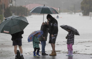
Sydney braced for another long night on Monday with more than 70 flood evacuation orders in place across New South Wales and further alerts being issued into the evening, despite a forecast that conditions could ease on Tuesday.
Large parts of the state have been hammered with record levels of torrential rainfall since Friday, placing about 32,000 people under evacuation orders including in several parts of Sydney.
On Monday evening, further evacuation orders were issued for low-lying parts of Woronora, Liverpool, Morebank, Georges Hall and Bonnet Bay amid “dangerous, rapid” river level rises at Woronora Bridge in excess of 2016 levels.

“It is forecast to ease possibly for [Tuesday] but the night-time will be a concern,” she said.
“I don’t want people to think they can move back into their houses … we’re going to make sure it’s safe and the community who have evacuated are in safe places. And we’ll be looking at where we can lift those orders tomorrow.”
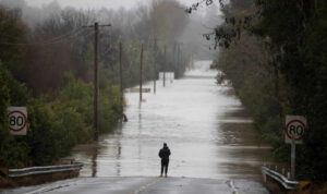
While rainfall has eased in some areas, a coastal trough is forecast to move north late on Monday, bringing damaging winds of up to 100km/h and possible heavy rainfall and flash flooding over the Illawarra, Sydney and parts of the Hunter and Central Tablelands.
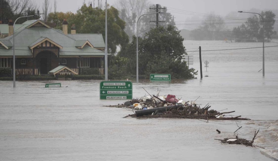
York said the Hawkesbury and Nepean valley remained the greatest areas of concern for authorities, with major flooding still occurring at Menangle, Wallacia, Windsor and North Richmond, while efforts were also being redirected to the Hunter and Liverpool.
The Hawkesbury river peaked at 14.18 metres in North Richmond on Monday morning, above the March 2022 level, while at Windsor the river was expected to reach levels similar to March 2021 and 2022.
Major flooding was also possible along the Wollombi Brook at Bulga into Tuesday, where the waterway was sitting at 3.9 metres and rising, while moderate flood warnings were in place for the Macquarie
Wow. A rain gauge near Brogers Creek in the Kangaroo Valley, NSW just received 868mm of rain during the 78 hours ending at 3pm on Monday. This is more rain than Melbourne, Canberra, Adelaide, Hobart or Perth typically receive in an entire year. pic.twitter.com/mjkcxw5bkf
— Ben Domensino (@Ben_Domensino) July 4, 2022
Some catchments have had more rainfall in the past three days than capital cities such as Melbourne, Canberra and Hobart have in a typical year. Brogers Creek in the Kangaroo Valley received a lashing of 868 mm of rain in the 78 hours to 3pm Monday, while Beaumont received 184 mm in 24 hours.
The Windsor Bridge in north-west Sydney is underwater for the third time this year, with residents again cut off from homes and businesses.
The unfloodable Windsor Bridge, underwater again. pic.twitter.com/7jLGd847cw
— Mostafa Rachwani (@Rachwani91) July 4, 2022
Some 3,900 requests for assistance have been lodged in the state since Friday, including 400 on Sunday evening alone.
NSW premier Dominic Perrottet said there had been 116 flood rescues in the past few days including a family of five, 83 of which took place on Sunday evening.


